Share this with your friends


813-992-7771
Real Estate Company
6817 Bayshore Road, Palmetto, FL 34221
- $5,495,000
- 3,287
- SqFt






- List Price
- $5,495,000
- Status
- Active
- Days on Market
- 60
- MLS#
- C7529326
- Property Style
- Mixed Use
- Year Built
- 1958
- Living Area
- 3,287
- Lot Size
- 449,539
- Acres
- 10.32
- Total Acreage
- 10 to less than 20
- Legal Subdivision Name
- East Terra Ceia
- MLS Area Major
- Palmetto/Rubonia
Property Description
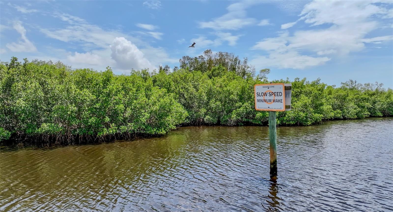
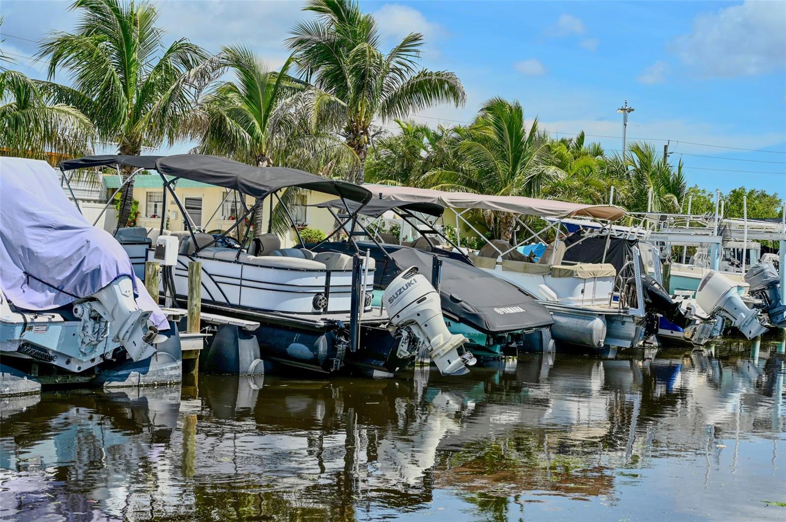
Palm View Marina is a premier income producing marine asset with significant waterfront redevelopment potential along Florida’s rapidly growing Gulf Coast. Located at 6817 Bayshore Road in Palmetto, Manatee County, the property encompasses 10.32± acres along McMullen Creek. Its protected waterfront setting offers navigable access to Terra Ceia Bay, Tampa Bay, and the Gulf of America. Privately owned submerged lands further distinguish this rare offering, creating a compelling combination of current commercial income, established marine infrastructure, and significant long term potential. Existing Marina Operations & Infrastructure Wet Slips: The operating private marina accommodates approximately 25 wet slips featuring distinctive floating, piling free air-lift systems that provide premium boat storage while enhancing the marina’s operational appeal. Vessel Suitability: The protected basin and approximately 10 foot bridge clearance make the property particularly well suited for center consoles, coastal powerboats, and other lower profile vessels. On-Site Improvements: The property includes a substantial concrete boat ramp, dry storage areas, a workshop, and an air conditioned member clubhouse. Redevelopment & Zoning Potential Zoned Planned Development Waterfront (PD-W), with a Village (VIL) Future Land Use designation, the property provides a strong foundation for a variety of potential future concepts, including: Expanded marina operations, Marine support businesses, Luxury residential or mixed-use development, Boutique hospitality or waterfront accommodations, or a secure private boating compound. Approximately 3± acres of usable upland are complemented by extensive mangrove lined waterfront, creating a naturally attractive setting with recreational and ecotourism appeal. All future uses and development concepts are subject to governmental approvals and buyer due diligence. Strategic Gulf Coast Location Situated along historic Bayshore Road, formerly part of the Old Tamiami Trail corridor, the property offers convenient access to US 41, I-275, and I-75. This strategic location provides excellent regional connectivity to Bradenton, Sarasota, St. Petersburg, Tampa, and the broader Gulf Coast market while preserving the quiet, protected character of a natural waterfront sanctuary. Expansive aerial views extend toward the Sunshine Skyway Bridge and the downtown St. Petersburg skyline. A Multifaceted Waterfront Investment Palm View Marina represents far more than an operating marina. It is a multifaceted waterfront investment offering income producing marine infrastructure, an established private marina operation, privately owned submerged lands, and the potential to create a signature Gulf Coast destination.
/u.realgeeks.media/floridasbestrealtor/me2.jpg)
Additional Information
- Taxes Annual
- $13129
- Community Features
- No Deed Restriction
- Zoning
- PDW/CH
- Air Conditioning
- Office Only
- Exterior Construction
- Block
- Foundation
- Block
- Pool
- No Pool
- Water Extras
- Assigned Boat Slip, Boat Port, Boat Ramp - Private, Boathouse, Bridges - Fixed, Fishing Pier, Lift
- Water View
- Canal, Creek, Marina
- Water Access
- Canal - Brackish, Creek, Gulf/Ocean, Gulf/Ocean to Bay, Marina
- Water Frontage
- Brackish Water, Canal Front, Creek, Marina in Community
- Flood Zone Code
- AE
- Parcel ID
- 2116500059
- Legal Description
- BEG AT NW COR OF W1/2 OF SW1/4 OF SE1/4 IN SEC 25, S 4.50 CHS (297 FT), TH E 6 CHS (396 FT), N BY E 4.83 CHS (318.78 FT), W 6.83 CHS (450.78 FT) TO POB, LESS: OR 1225 PG 222 FOR RD R/W DESC AS FOLLOWS: COM AT A 2" IRON PIPE MARKING THE CENTER OF SD SEC; TH N 89 DEG 42 MIN 29 SEC E, 757.31 FT ALG THE N LN OF SD SE1/4 TO THE SURVEY LN OF OLD U.S. 41, BAYSHORE RD; TH S 11 DEG 35 MIN 50 SEC W, 1094.56 FT ALG SD LN TO THE BEG OF A CURVE CONCAVE TO THE W, HAVING A RADIUS OF 5729.58 FT; TH SWLY ALG SD LN, 325.00 FT THRU A C/A OF 03 DEG 15 MIN 00 SEC TO THE END OF SD CURVE; TH S 14 DEG 50 MIN 50 SEC W, 155.04 FT ALG SD SURVEY LN; TH N 75 DEG 09 MIN 10 SEC W, 33.00 FT FOR A POB; TH CONT N 75 DEG 09 MIN 10 SEC W, 17.00 FT; TH S 14 DEG 50 MIN 50 SEC
Listing courtesy of NATIONAL LAND REALTY LLC. 941-322-7002
Mortgage Calculator
StellarMLS is the source of this information via Internet Data Exchange Program. All listing information is deemed reliable but not guaranteed and should be independently verified through personal inspection by appropriate professionals. Listings displayed on this website may be subject to prior sale or removal from sale. Availability of any listing should always be independently verified. Listing information is provided for consumer personal, non-commercial use, solely to identify potential properties for potential purchase. All other use is strictly prohibited and may violate relevant federal and state law. Data last updated on